Sub Programme Area 103
103.1 GIS-Based Forewarning Model for Pest Management
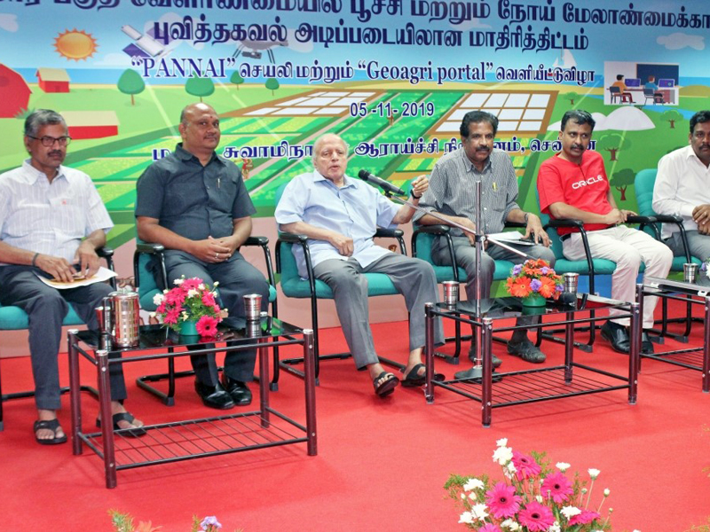
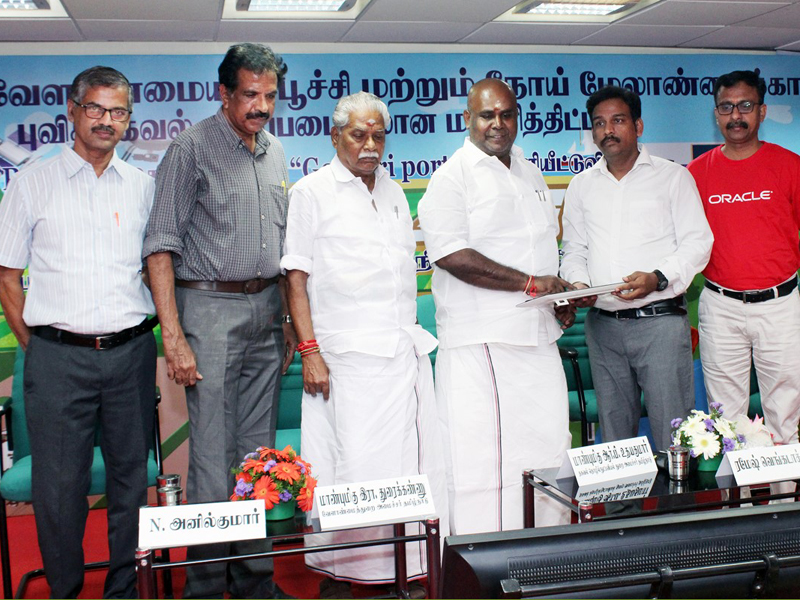
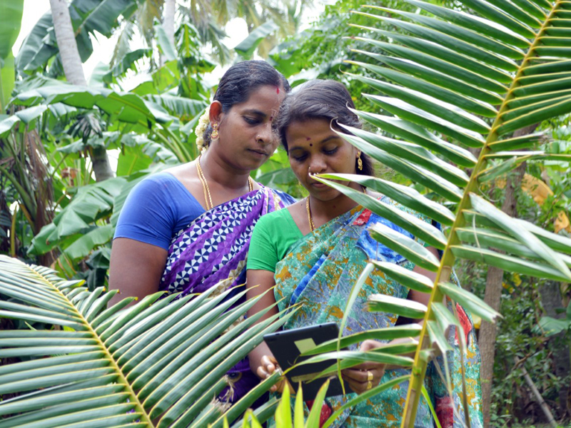
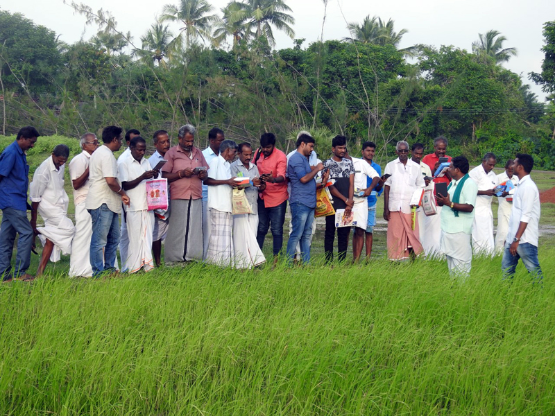
The Pest disease Advance Notification and Need-based Agriculture Information (PANNAI) app, developed to provide GIS-based forewarning for pest management (GFPM) in agricultural crops to small and marginal agricultural farmers of Vedaranyam and piloted tested in 2018–19, and a GeoAgri portal were formally launched on 5 November 2019 by Mr R. B. Udhayakumar, Minister for Revenue and Disaster Management and Information Technology, and Mr R. Doraikannu, Minister for Agriculture, government of Tamil Nadu, respectively. In the PANNAI app, the field measurement boundary (FMB) and land records of farmers have been digitized and land-wise advisories are being given based on the three automatic weather stations installed in project villages. It connects nearly 10000 farmers with the scientific community, especially agricultural experts, to manage the crops. Two hundred android tablets with PANNAI app installed were provided to progressive farmers of the project villages, who were trained to use it. Another 200 progressive farmers from Adanur, Kathripulam, Kadinalvayal and Thennadar villages were trained at Tamil Nadu Rice Research Center, Aduthurai, to tackle climate change issues in agricultural crops. Infrared-based drone survey was completed in Vanduvancherry, Thennadar and Kadinalvayal to map the farmlands for the android app and also to evaluate the health of paddy crop using digital image processing techniques. About 250 soil samples collected from different farmers’ fields were analysed for nutrients such as NPK and other micronutrients. Soil health cards were issued to the farmers with the recommended doses of fertilizer required for cultivation of crops. Scientists from Pandit Jawaharlal Nehru College of Agriculture and Research Institute (PAJANCOA & RI), Karaikal, visited the farmlands and advisories were provided to the farmers.
103.2 Quantification of Biomass in Pichavaram Mangroves Using Remote Sensing
Quantification of biomass in the Pichavaram mangrove wetland using remote sensing (RS) technology was initiated. Mangrove species classification has been carried out using IRS P6-LISS IV satellite images for the year 2019, and the geometric errors were rectified using sentinel 2 images as a base in cartographic projection (UTM Zone 44N, WGS84). After the preliminary image classification, species diversity, species location, and other land use/landcover were collected to reclassify using the sample points collected from the field and accuracy assessment was carried out. Species zonation map was prepared and parameters such as diameter at breast height (DBH), circumference at breast height (CBH), and plant height were measured in 101 random sampling plots.
103.3 Mangrove Community Zonation and Biophysical Characterization of the Tamil Nadu Coast
Space Applications Centre (SAC), ISRO, Ahmadabad, sanctioned a project to update the mangrove community zonation at a scale of 1:25000 for the Tamil Nadu and Puducherry coasts using the LISS IV satellite images and satellite data of IRS P6 L3 and L4 obtained from them. As per the guidelines of SAC, the digital number (DN) values of the pixels in the satellite images were converted to radiance values using model maker from the ERDAS software, and the radiance images were used for preparing the mangrove zonation maps. The hybrid classification technique has been adopted to classify the satellite images for community zonation of the mangroves. Extensive ground truthing and biophysical survey is being carried out in the coastal areas of Villupuram, Cuddalore, Thanjavur, Ramanathapuram, Tuticorin, Kanniyakumari and part of Puducherry state (Karaikal) to validate the processed satellite images and classified land-use divisions and mangroves.
103.4 Water Security and Climate Adaptation in Rural India: GIS Component
Water Security and Climate Adaptation in Rural India (WASCA) project is being implemented to enhance water security and climate adaptation in Thiruvannamalai and Ramanathapuram districts of Tamil Nadu. GIS and RS technology are being used for composite water resources management (CWRM) at the gram-panchayat (GP) level. The soil profile, land use/land cover, drainage, micro watershed and other relevant data for village-level planning are being prepared using ArcGIS from data provided by the Rural Development and Panchayat Raj Department, Government of Tamil Nadu, for 429 GPs of Ramanathapuram and 860 GPs of Thiruvannamalai districts. Government officials and engineers of Ramanathapuram were trained in GIS tools such as Google Earth Pro, Bhuvan and ER mapper for the effective planning of GIS-based CWRM. The GIS layers, such as drainage map, land use/landcover, salt-affected land, ground prospectus map, watershed, geomorphology, geology, lineament, waterbody and so on, are being generated from ISRO-Bhuvan database for Ramanathapuram district. These generated maps are converted into KML format and processed in Google Earth to prepare the CWRM plans scientifically for the GPs.